

Automated Wetland Determination Form
I built an app using survey123 that allows field staff to determine the presence/absence of a wetland according US Army Corps of Engineers guidelines. Survey123 is nice because it allows for fast updates and circumvents the app store process.
The form has three main sections: hydrology, vegetation, and soils.
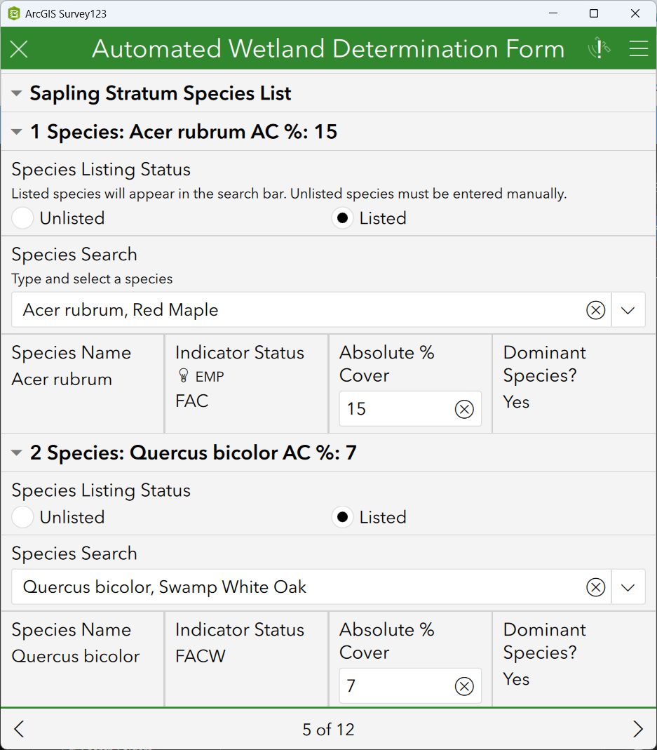
The form contains a list of all USACE listed species! Unlisted species can be added too.
I wrote custom javascript functions that are called asynchronously to evaluate user input in the form. For example, when a new species is added to the vegetation form it automatically determines its indicator status and calculates its dominance in the stratum against all previous entries and in turn updates their dominance accordingly. Statistical tests were also included and coded to automatically calculate if the presence of hydric vegetation is enough to determine wetland status.
The soil section incorporates a unique algorithm I wrote that calculates munsell soil color chart color contrast between the reduced and matrix soil components - AKA DIRT COLOR MATH ︎
Finally when a user submits the form it makes its way into power automate where it populates a report template, stores the document, and emails the completed data form, photosheet, and results tables.
Similar to the situation with the CEDAR log, I had originally coded a reporting service using custom javascript, webhooks and webserver, but was forced to pivot to power automate when the hosting environment license was dropped by our IT division. It helped to have a staff member assist with setting that up!
*survey123, javascript, xlsforms, arcgis online, power automate used to create and manage the app and reports